STUDY DESIGNS 3
observational studies
using existing gradients in for instance habitat fragmentation.
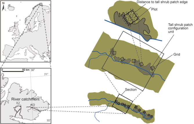
Figure 2. Location of the study area on riparian sediment plains at altitudes between 110 and 290 m above sea level on the Varanger Peninsula (70° N), eastern Finnmark, northern Norway, and a schematic indication of how sampling units were arranged hierarchically for sampling of spatial configuration of tall shrub patches (dark green) and the diversity of the herbaceous vegetation (olive green). Within both of the two river catchments (Komagdalen, KO; Vestre Jakobselv, VJ), tall shrub patches of willow were found in three distinct sections. Tall shrub patch configuration was sampled in 1-ha units within the sections. In the centre of these units, diversity of the herbaceous vegetation was sampled in grids of 15 m x 15 m. One side of the grids was aligned to the tall shrub patch edge. Herbaceous vegetation diversity was quantified in 13 plots spread within each grid at distances of 0, 7.5, and 15 m from the tall shrub patch edge.
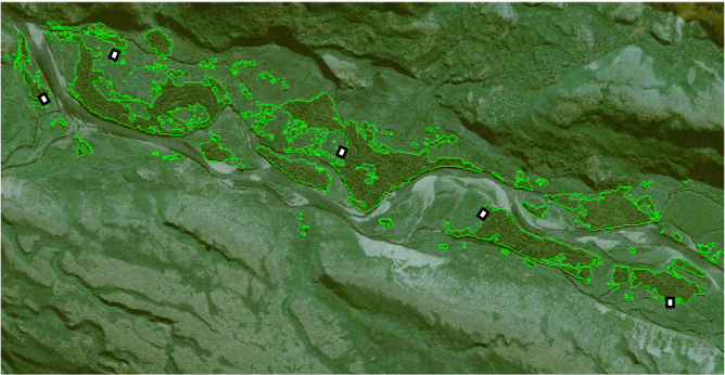
An example of an aerial photograph from which tall shrub patch configuration was delineated and quantified in terms of aerial fill, patch density and edge density. The white patches refers to the grids of the study design outlined above.
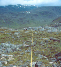
Photo EcoFinn-project

Our aim is to stretch our study designs over landscapes and regions that cover scales relevant for our predictors (such as large herbivores or climate gradients). We often find idiosyncratic responses to our predictors along these scales.
We believe knowledge covering such scales is a must for valid planning of future research, monitoring and management.